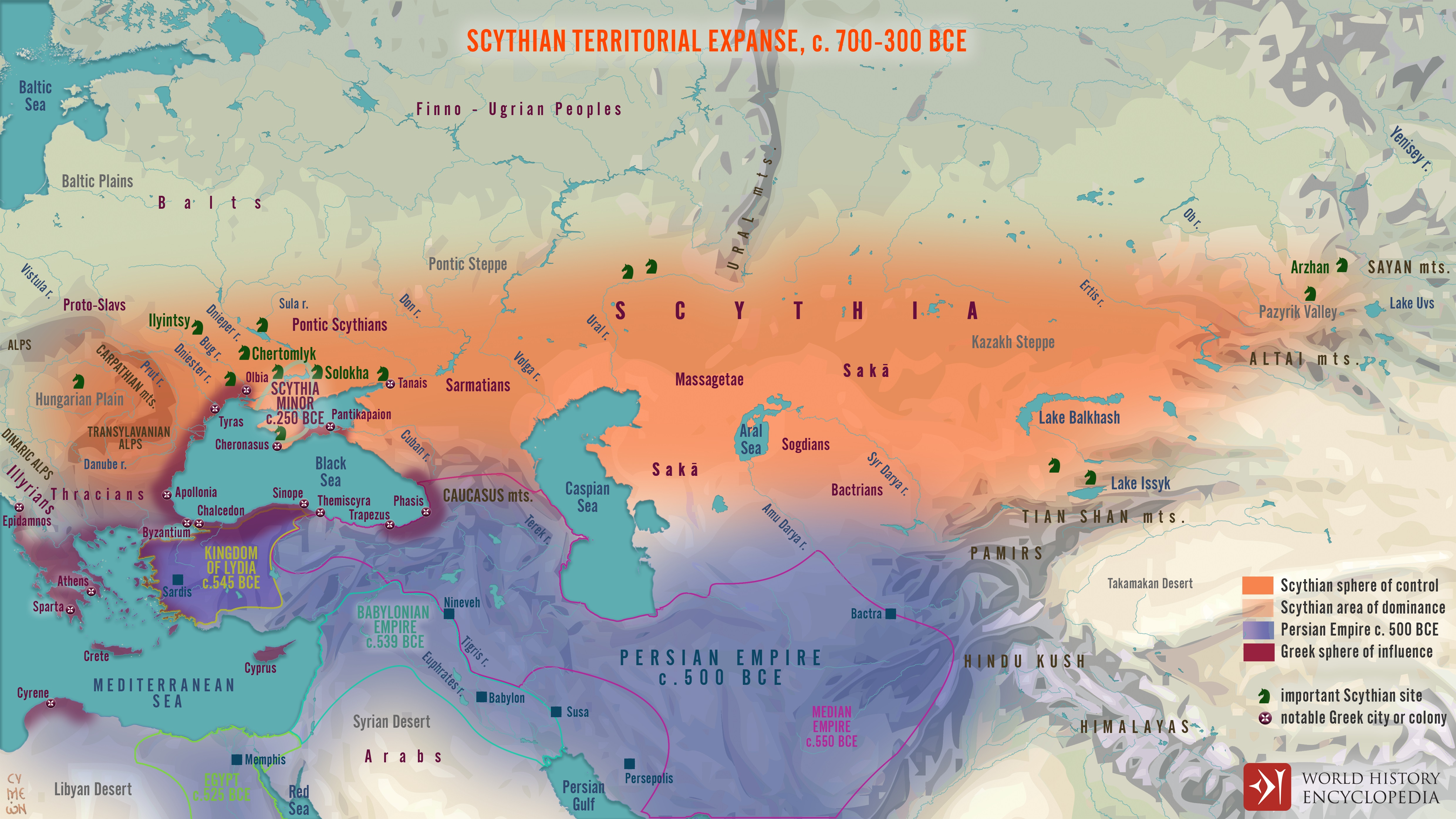
Map of Scythian territorial expanse 700-300 BCE
"How numerous the Scythians are, I was not able to learn exactly, and the accounts that I heard did not tally, some saying that they are very numerous, and some that they are few, so far as they are true Scythians. But this much they let me see for myself: there is a region between the Borysthenes and Hypanis rivers, whose name is Exampaeus; this is the land that I mentioned when I said that there is a spring of salt water in it, whose water makes the Hypanis unfit to drink. In this region is a bronze vessel, as much as six times greater than the cauldron dedicated by Pausanias son of Cleombrotus at the entrance of the Pontus. For anyone who has not yet seen the latter, I will make my meaning plain: the Scythian bronze vessel easily contains five thousand four hundred gallons, and it is of six fingers' thickness. This vessel (so the people of the country said) was made out of arrowheads. For their king, whose name was Ariantas, desiring to know the census of the Scythians, commanded every Scythian to bring him the point from an arrow, threatening death to all who did not. So a vast number of arrow-heads was brought, and he decided to make and leave a memorial out of them; and he made of these this bronze vessel, and set it up in this country Exampaeus. This much I heard about the number of the Scythians."
-Herodotus, The Histories, 4.81
 |
| Map of Scythian territorial expanse 700-300 BCE. World History Encyclopedia. |
Source:
Quote:


Comments
Post a Comment