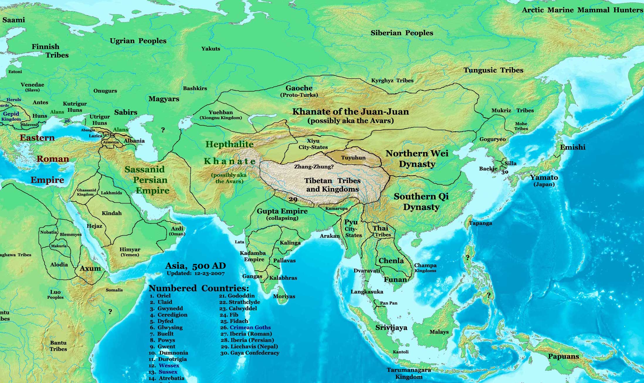
Maps of the Hephthalite (White Hun) Empire around 500 CE
There are various maps of the Hephthalite Empire (White Huns) online, some vary quite a bit as territory ownership changed. I'm not sure how accurate they all are but I feel like these are the most accurate maps I could find based on actual info available. Note that they were neighbors of the Magyars and the last Xiongnu Kingdom, Yueban. The Hephthalites seem to have peaked in the 520s CE:
"522 : Apex of Hephthalite power. Chief of the Juan-juan flees to the Hephthalites for protection. Hephthalites dominate north and south of the Tien Shan range, at least to Khotan in the east probably more, and up to Khurasan in the west. A separate Hephthalite Empire controls much of India. Forty countries (including the Sassanians) are in tribute. Hephthalite centers are at Ghur, Balkh, Warwaliz (north of today's Kunduz near the source of the Oxus) and Hsi-mo-ta-lo. The entire empire probably comprises fifty to sixty thousand individuals." (University of Washington).
Source:
https://www.worldhistorymaps.info/medieval/500-ad/
https://www.worldhistorymaps.info/civilizations/hephthalite-empire/
https://www.historyfiles.co.uk/FeaturesFarEast/CentralAsia_MapAD500.htm
Quote:
https://depts.washington.edu/silkroad/exhibit/hephthalites/hephthalite.html


Comments
Post a Comment